
(0 reviews)
Login to leave a review
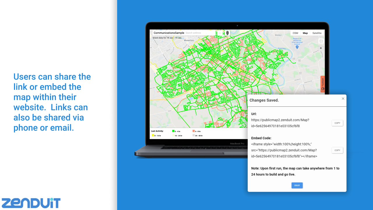
ZenduMaps is a mapping application that enables users to create shareable, customizable & public map links that display vehicle GPS location, historical trip data and measures vehicle activity against set compliance rules.
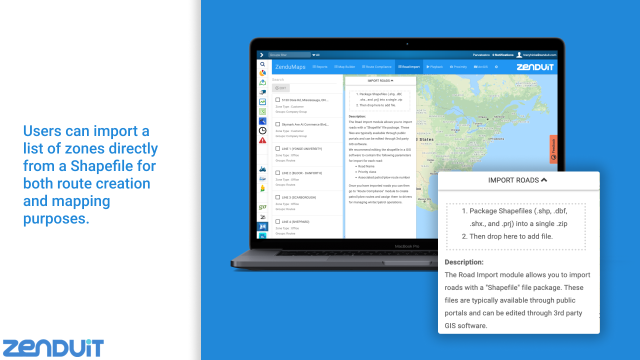
To use the Add-In, provide the road data source files in shapefile format or a specific link/contact to the resource where the shapefile data may be captured.
Features And Benefits
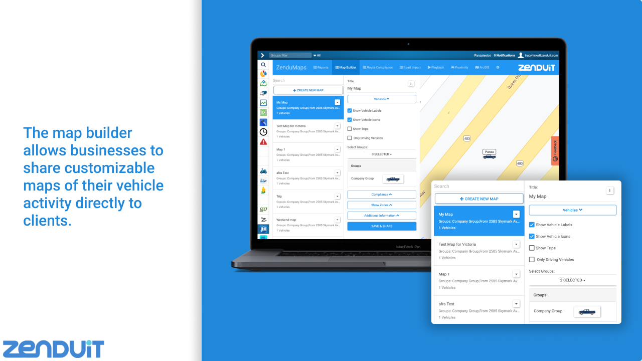
Map Builder tool
Publicly share & customize a map to show
- Stops
- Historical trips
- Compliance & progress against predefined routes
- Traffic Layers and more
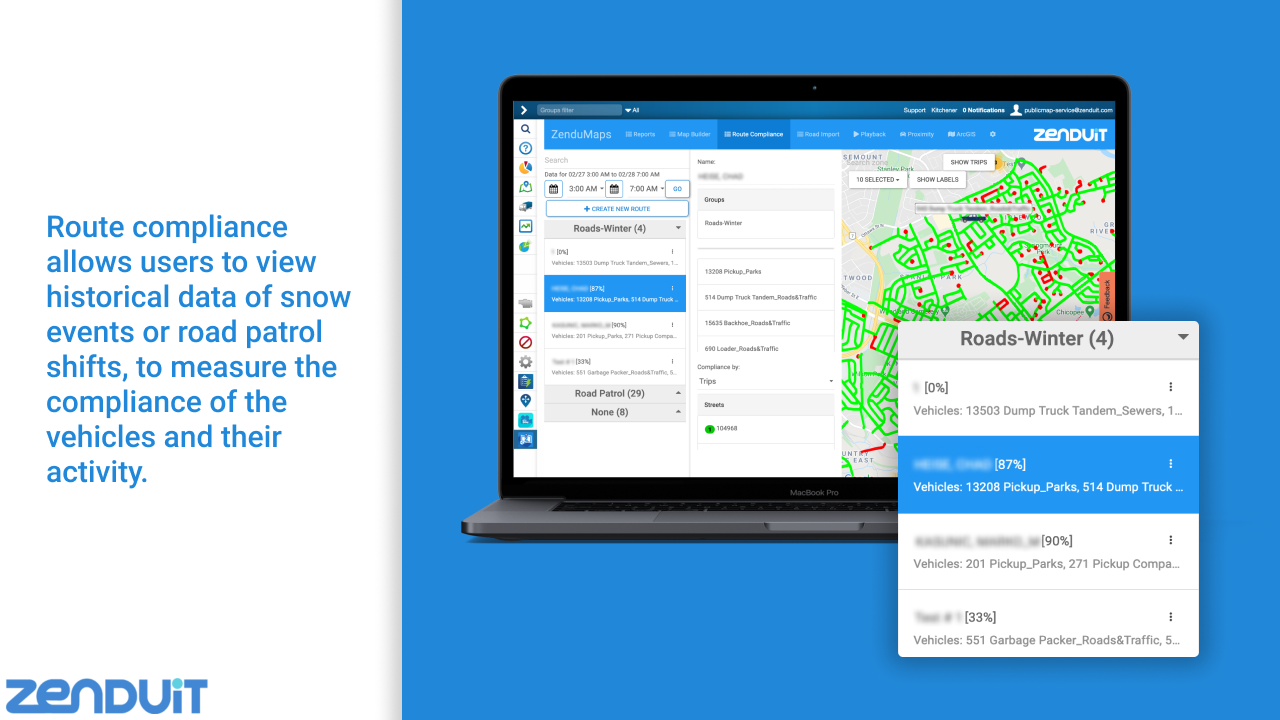
Route compliance tool
- Measure vehicle activity against a compliance standard.
- Compliance measured based on time or completion percentage
Shapefile Import tool
- Drag and drop shapefiles into the tool
- Mass naming by selecting shape properties or auto-incrementing
- Preview files before import on a map
- Warns and displays naming and shape conflicts if they already exist in Geotab
- Mass configure zone properties of newly added zones
- Build rules and reports against roads (ie. for Winter Maintenance, Waste Management, etc…)
ArcGIS ESRI Map Layer Integration
- Send the Geotab vehicle's Location/Trip/ Exception data right to your ArcGIS account
Proximity & Playback Tool
Device Plan Requirements
Base
Top Industry Use Cases
Regions
Canada
United States
Supported Languages

English